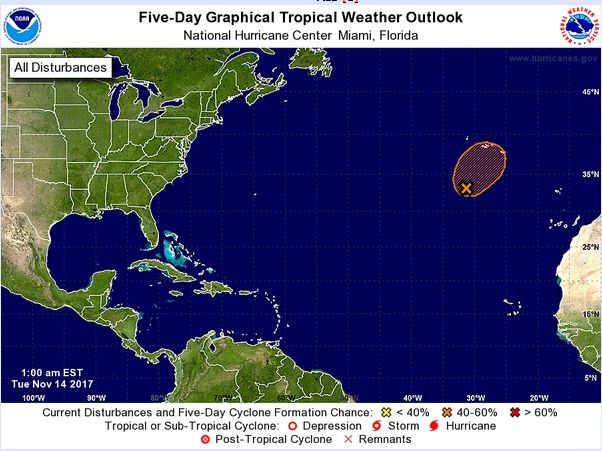
La baja subtropical 96L al sudoeste de las Azores podría convertirse en tormenta subtropical Sean
Si fuera así, sería nombrada como Sean, cuando entramos en la segunda quincena de noviembre de 2017. Recordar que la temporada oficial de huracanes de 2017 finaliza este 30 de noviembre.
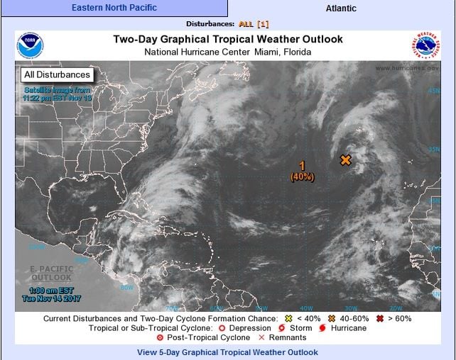
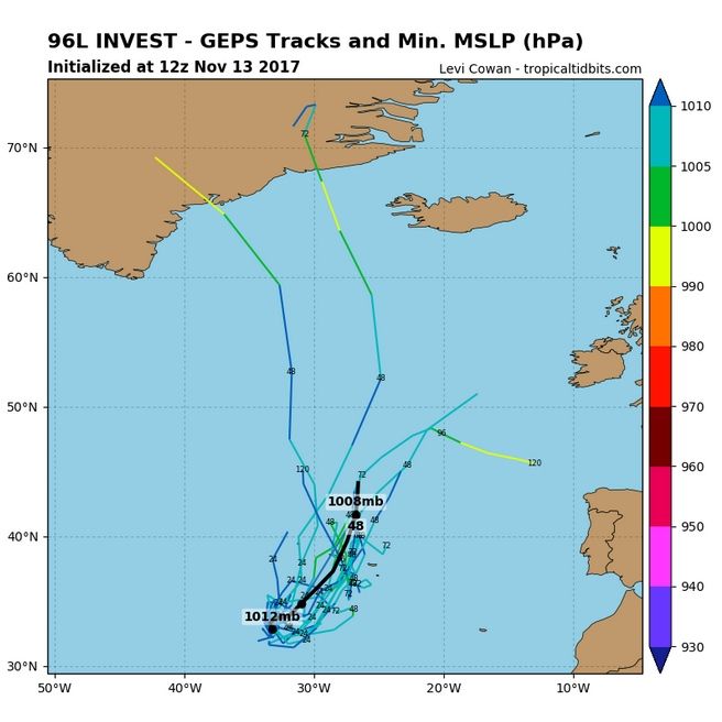
Un sistema de bajas presiones subtropical podría convertirse en una tormenta subtropical. El sistema 96L se encuentra a unos 645 km al suroeste de las Islas Azores.
El sistema fue designado Invest 96L por NHC durante el fin de semana y se mueve lentamente hacia la zona marítima y terrestre de Azores. El centro de bajas presiones se mueve sobre aguas a 24 ° C en un área de baja cizalladura.
El CNH da ciertas probabilidades que el sistema se transforme en una tormenta subtropical en los próximos días.
ZCZC
Tropical Weather Outlook
NWS National Hurricane Center Miami FL100 AM EST Tue Nov 14 2017
For the North Atlantic...Caribbean Sea and the Gulf of Mexico:
1. Showers and thunderstorms have increased a little during the pastseveral hours in association with a low pressure system locatedabout 400 miles south-southwest of the Azores.
Additionaldevelopment of this system is possible, and it could become asubtropical cyclone during the next couple of days beforeupper-level winds become unfavorable. Regardless of development,this low is expected to produce winds to near gale force during thenext day or two while it moves slowly northeastward.
* Formation chance through 48 hours...medium...40 percent.
* Formation chance through 5 days...medium...50 percent.
Additional information on this system can be found in High SeasForecasts issued by Meteo France under WMO header FQNT50 LFPW andavailable on the web http://www.meteofrance.com/previsions-meteo-marine/bulletin
Forecaster Cangialosi
Las predicciones a 48 h sitúan el centro del 96L en las cercanías de las Islas Azores